Brecon Beacons

Saturday, 28 April 2012

Trekmates Flameless Cook Flask

For some time I have been trying the Trekmates Flameless Cook Flask. This consists of a metal cup that sits inside a plastic outer casing with a protective sleeve. The idea is that you cook without the use of gas or other heating implements. They also make a Cook Box for cooking whole meals.

Flameless Cook Flask

The cooking is achieved by the use of a special sachet that reacts when it comes in contact with water. This produces the heat that heats up the liquid. To initiate the reaction the sachet is removed from its waterproof packet and placed inside the plastic casing. By pouring on the specified amount of water the reaction is initiated. The metal cup is then inserted, the cap fitted and the liquid inside it will heart up.

So far I have used this in the Lake District, Cairngorms and even on long distance train journeys. This particular flask can be used to make hot drinks or the pasta snacks that require hot water. It is great for heating up something when you are out on the hill, especially when you don’t have access to a stove. On the train you do get some odd looks but it is better than the usual fare they offer. The heat sachets work out at about £1.40 each so it is not necessarily that cheap but its flexibility outweighs this.

Certainly as an emergency heat source it is invaluable, but there are a variety of self-heating meal packs coming on the market that could fill this niche. 

A Walk in the Moelwyns

For what turned out to be the best day of the extended weekend in Snowdonia I headed over to Croesor. Tucked in the valley between Cnicht and the Moelwyns this pleasant village has a small National Park car park and toilet, nearby is a small friendly cafe.
Most books seems to suggest going round in a clockwise direction, taking the higher Moelwyn Mawr first. However as it and Cnicht across the valley where shrouded in clouds, the best option was to take the lower Moelwyn Bach first in the hope that the cloud base would lift.
The walk therefore started by heading out along the road towards Tan-y-Bwlch, after passing a farm you eventually reach a block of forestry. Here the footpath takes you through the moss covered trees to the open moorland. The footpath actually heads out along the boggy valley but the route up to Moel Bach is best tackled by heading uphill and following is NW shoulder/ridge to the summit.
IMAG0149
After admiring the view of distant Portmadog and the ___ estuary, the path descends steeply on the east side overlooking the Lyn Siwlan reservoir. Then from the Bwlch a easy scramble up Craigysgafn gains access to Moelwyn Mawr, which sadly was shrouded in cloud at the time. A brief chance to admire the obscured view and the path then descends on the west side and then skirting around the open wound of the former quarries. The destination being the top of Moel-yr-hydd with views into Blaenau Festiniog below.
 IMAG0159
Heading across to the quarry building near Llyn Creosor I joined the path down to the large quarry building footprint and track back to the village. This last part being the culmination of a walk I took my sister on nearly a year ago as part of her training for a charity walk in the Grand Canyon. On that occasion the walk was to stretch the muscles after her first ascent of Snowdon the previous day.
This year like last the cafe provided a welcome end point with its refreshments and homemade cakes. A good days walk with some unexpected views. This wasn’t the end of the weekend as i then had another two days in the area as I had to attend a 16-hour outdoor first aid course.

Saturday, 21 April 2012

Snowdon Geology for MLs

Today was to be a day on Snowdon learning about its geology with Paul Gannon, author of the Rock Trails books. This was a CPD day organised through the Mountain Leader Training Association. During the day we learnt all about the different volcanic rocks, its different formations etc.

IMAG0137

The route went up the Miners’ Track passing the Lower Rhyolitic Tuffs, Basalts and there various sub forms. Despite the appalling weather  we made good progress up Snowdon discussing the effect of tectonics on the structure of the mountains. The subsequent effect of glaciations was evident in the  four cwms that once held the glaciers. As we ascended each got progressively smaller.

The importation of rocks to stabilise the paths provided additional discussion material, and not just of a geological nature.

The route down was quicker but no less informative. Concluding with a hot mug of coffee in the Pen y Pass cafe, this was a good day on Snowdon.

Friday, 20 April 2012

Moel Hebog ridge walk

This weekend I headed off to Wales on a Thursday evening , arriving at Snowdon Ranger Youth Hostel around 9pm. The drive through Snowdonia was pleasant and it made a change not to have to carry all my stuff, unlike the earlier trip to the Cairngorms.

This was the first time at this hostel, which was a pleasant enough place. A good location for the west side of Snowdon. Not too far from Rhydd Ddu where I was staying at the end of February.

On Friday I headed down to Beddgelert and then walked up to Moel Hebog. The route started at the Royal Goat Hotel and then passed through the area now occupied by the Welsh Highland Railway. Once past this the route follows the road to just before the farm and then heads out across the open moorland. The gradual climb steepened & passed through an area of simple scrambling and scree. The summit was shrouded in mist and covered in a fresh layer of snow, which indicated no one had been up since it settled.

IMAG0136

After locating the trig point the path descends down the north side alongside the drystone wall.

The route then passed through a cleft in the rock and up to Moel yn Ogol and then mostly along a ridge to Moel Lefn. This was mostly the same as the first day of my ML practice expedition. The difference was today was wet and claggy whereas then it was boiling hot and parched. On that occasion we had headed down to the disused mines and camped near the reservoir. This provided my first and so far only experience with ticks!

This time the route headed into Beddgelert Forest, which proved to be a nightmare. The footpath through  the forest was a cross between quagmire, bog and stream bed. After finally extracting myself from its grip it was a short walk along the road into the village.

Tuesday, 10 April 2012

Easter in the Cairngorms

Easter 2012 was spent in walking in the Cairngorms with The Rucksack Club. The first challenge was to get there by public transport. Luckily there were no hiccups along the way and the three changes of train to get to Aberdeen. From there it was a two hour bus journey to Braemar. It total it took 10.5 hours to get up and 12 to get back as I ended up having to spend over two hours in Aberdeen before catching the train home. In total the costs of getting there by public transport was around the cost of a full tank of petrol.

IMG_1999
Entrance to Stable Block
We stayed at the National Trust for Scotland’s Mar Lodge Basecamp, which was well appointed for 12 people in four bedrooms, with a good sized kitchen, dinning room and lounge area. The latter had a TV for checking the weather forecasts, mobile reception being very poor.
Situated in the old stable block the basecamp is ideally situated for access to the mountains in this area of the Cairngorms. Over the Easter weekend the adjacent lodge was open to the public and we had the opportunity to see the rooms which are not often open to the public. The sheer number of deer skulls in the main reception rooms and the ballroom is not to everyone’s taste!
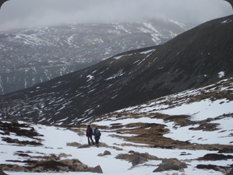
On Good Friday I walked from the Lodge down to the Linn of Quich and then followed the track up through the forest and intro the hillside beyond. After the recent snowfalls there was still plenty of snow on the ground, although it was fairly soft going. After following the track for some time the route took me uphill on a non-descript path to Carn na Criche and its cairn. From here it was a case of following the ride to the summit of Carn na Drochaide with its wide stony plateau. The path down constantly disappeared into the snow but the way down was across the spur of Carn Dearg and then across the boggy area towards the woods above Alanaquoich.
IMG_1997
On the way up Lochnagar
Saturday started early with a drive over to Spittal of Glenmuick and the start of today’s walk up to Lochnagar. The weather forecast was for an unpromising afternoon, hence the need to start walking early, despite this the car park was already filling up. Despite this we didn’t see an awful lot of people during the day.
There was a fair amount of snow as we ascended and we followed the main route up to the summit. Visibility was poor on top and following compass bearings we passed the first cairn and then onto the cairn on the top of Cache Carn Brag. The route down was to take the path down via the Falls of Glasalt and onto Loch Muick and the shore path back to the carpark.

On Sunday a couple of us headed out to tackle An Sochan. Parking by a woodland at the side of the A93 we followed the valley up until the second side stream and then headed uphill to the cairn and on up the bleak summit. As we ascended we came close to a small group of Mountain Hares still resplendent in their white winter coats. After admiring the view  from the summit cairn we headed back to a shelter cairn for some refreshments. The return was merely retracing our steps.

IMG_2017
Looking down upon Mar Lodge
Monday morning everyone else departed the area on their way home or to tackle other peaks. My stay was to continue for another day, this time staying at the Youth Hostel in Braemar. After the two Munros of the previous days I headed up Montone  the local Corbett. The trig point on the summit is completely overshadowed by an enormous transmitter mask and associated buildings. Despite that the views from the summit were very good and it was possible to look down upon Mar Lodge and see Carn na Drochaide from the walk on Friday. A Ptarmigan loitered for a while in from of me and allowed an excellent view of this interesting bird.

This was a great few days in the Cairngorms, with reasonably good weather, fantastic accommodation and good company.

Monday, 30 January 2012

Aran Fawddwy in the snow

Looking towards Pen Main
This weekend was spent in the Arans a fantastic walking area in North Wales. The drive up on Friday night was uneventful and relaxing, even getting through Birmingham on the M6 was easy going. The lanes around Dinas Mawddwy were on the other hand more challenging.
Saturday morning and the sun was shining and it promised to be a good day despite the ominous weather forecasts. Beyond Dinas Mawddwy there is a small car park near Cwm Cywarch. The path leaves the track by a bridge across the stream and then a sunken lane takes you out into the valley above Afon yt Hengwm. The path slowly climbs above the valley and swings around to Drysgol.

View from Drysgol to Aran Fawddwy
 The snow was increasing in depth by this stage and the icing on the mountains was rapidly becoming more of a reality. As we followed the ridge keeping the fence on our right Aran Fawddwy could be seen in its full winter glory.

The path passed a memorial cairn for Mike Aspain of RAF St Athan mountain rescue team who was killed by lightning here. The path would normally be fairly straight-forward but with snow and ice covered rocks it was a more interesting experience.

Following the ridge, looking towards the memorial cairn by Drws Bach

The summit of Aran Fawddwy
 The final trudge led to the summit of Aran Fawddwy with its snow caped trig point & time for a bite to eat. The snow in places was up to knee deep and invariably your boot slowly descended through the snow layers making it tough going.

The descent was along the fence line running in a south-westerly direction towards Glasgwm. An extremely boggy path even at this time of year. The sections of board walk were more of a hindrance with their ice covering, but no doubt a blessing at other times of the year.


After 2 km or so the path veers downhill along a gully. The pond beside the fence marks the beginning of the path down which becomes very steep. Now below the snow line the path was still slippery due to film on the rocks and a saturated top soil. The path crosses a few side streams before reaching a wide footbridge and a more gentle path down to Bleaencywarch. The path passes around the farm and back to the car park. In total this was a 12 km walk which took around 5 hours of walking through snow and bog.

The view or lack of it
 The Sunday was an altogether different day, with poor visibility and gusting snow/sleet showers all day. as the day progressed it descended further into the valley and a slog up to the pond below Glasgwm was the limit of the days activities.
The lure of warm soup and time to dry out before the journey home proved too strong.


Monday, 16 January 2012

Dunnerdale, Lake District Weekend

This weekend has been my first real opportunity of the year to get out into the hills. The weekend started with a shared lift up to the lower part of the Dunnerdale Valley with members of one of my local mountaineering clubs. The accommodation was in club hut which provided an excellent base for getting into an area of the Fells I haven't been to before.

Dunnerdale Fells
Saturday presented us with bright skies and interesting light to view the fantastic views. The walk was not overly ambitious and took us through the coniferous forests at Ulpha Park along a forestry track past freshly felled trees. The low temperatures meant that in the main the churned up ground was rather crispy, otherwise it would have rather less pleasant. The Dunnerdale Fells looked rather promising and we could clearly pick out our target, Stickle Pike in the distance.

Looking towards the Dunnerdale Fells

A short section of road took us to Ulpha Bridge where we could get into our first area of Open Access land. The route up to Stickle Pike was a bit non-descript in places but it was easy to pick out a route to its cairned top. Passing Stickle Tarn on our descent we headed off downhill and eventually found ourselves on the banks of the River Duddon. Two places to cross were marked on the map but the large stepping stones were rather unappealing. A brief attempt was made at crossing but the flow and slippery nature of the stepping stones looked likely to lead to a dunking in the sub-zero water.

Stickle Pike, Dunnerdale Fells

Retracing our steps we headed back to Ulpha Bridge along the bridleway which rejoined our original route at Birks Wood. The latter part of the walk took us through numerous fields bounded by drystone walls. Each had protruding stones to enable you to walk up and down the other side of the wall, however the low angle of the light made spotting them rather problematic. By the time we reached our destination the light was rapidly failing but it had been a refreshing day.

Harter Fell
The logistics of Sunday meant we only had time for a short walk, so we decided on a quick assault of Harter Fell. Parking up at the Forestry Commission carpark at Birks Bridge in Dunnerdale Forest we route marched up along the forestry tack to its termination point. Here it joined a rather boggy and frozen bridleway along the south western flank of Harter Fell. The final 300 or so metres up were a bit of a slog, especially after Christmas festivities and inactivity.
On Harter Fell

The view was well worth it and low angle of the sun added an autumnal glow to the scene. The descent down its south-eastern flank eventually led us back to the forest track by Birks and then onto the carpark. An interesting few hours spent in the company of a Fell what described by Alfred Wainwright as "beautiful."
Looking towards Green Crag

Overall a good weekend walking in the Lake District with weather you would not normally expect at this time of year. Hopefully the next trip to North Wales will be as much fun.